Woodland management
Published 12 February 2025
Applies to England and Wales

© Crown copyright 2025
This publication is licensed under the terms of the Open Government Licence v3.0 ����ֱ��. To view this licence, visit or write to the Information Policy Team, The National Archives, Kew, London TW9 4DU, or email: psi@nationalarchives.gov.uk.
Where we have identified any third party copyright information you will need to obtain permission from the copyright holders concerned.
This publication is available at /government/publications/natural-flood-management-evidence/woodland-management
1. Catchment woodland
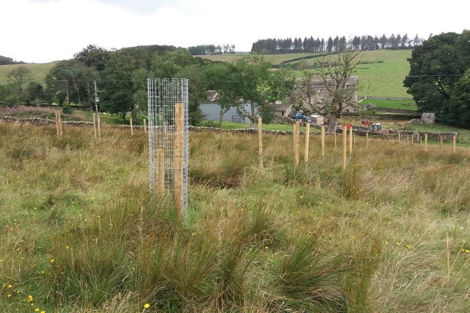
Catchment woodland at Mallerstang and Graythorne. Image credit: Peter Lesson, Woodland Trust
Catchment woodlands are the total area of all woodland within a catchment.
It combines woodland cover of all types and species. It includes plantations, plus specific forms where they are present, such as cross-slope, riparian and floodplain woodland.
1.1 What we know
We have medium to high confidence in the effect that catchment woodland has on flood risk, because there have been significant updates to evidence. However, there is a lack of evidence in large catchments and for large events.
It is thought that catchment woodland:
- can reduce peak flows, with the largest reductions seen for smaller events, with the benefit possibly declining as flood magnitude increases
- affects flood generation and conveyance through increased interception, wet canopy evaporation, soil permeability and storage, and increased surface roughness
- can be more effective in smaller catchments, but this may be due to a lack of data for larger catchments
- can have impacts on peak flows that are difficult to detect when the extent of planting or felling is <15 to 20% of the catchment and catchment size is greater than 100 km2; this does not necessarily mean that catchment planting on smaller scales or in larger catchments may not influence flood risk
- can cause a large range of peak flow reductions according to modelling studies, with an important factor being the ‘scale’ of woodland planting within a catchment, although some papers suggest that ‘location’ is important
- with coniferous planting tends to have a greater impact on peak flows than broadleaved woodland (however, this depends on management style and tree age; for example, ditching and/or road networks can increase peak flows, and coniferous woodland is only more effective than broadleaved when both are ungrazed)
1.2 Examples
In 9 catchments in Cumbria, peak discharge was monitored for 28 storm events. For storms with a return period of more than 1.5 years, woodlands exhibited approximately 55% lower peak discharge than pastures (Monger, Spracklen and others, 2022).
A monitoring study at a clay site in Warwickshire found that tree planting can increase soil infiltration, even in less permeable geologies. Infiltration was seen to be significantly higher at close proximity to trees (10 cm versus 200 cm): mean infiltration was higher at 10 cm, by 76% in winter and 25% in summer, compared to infiltration at 200 cm (Revell and others, 2022).
Long-term monitoring in Glensaugh, Scotland found that in ungrazed forest plots, soil hydraulic conductivity was higher under Scots pine forest (1,239 mm hr-1) than under sycamore forest (379 mm hr-1) and was much lower under pasture (32 mm hr-1) (Chandler and others, 2018).
1.3 Multiple benefits
Catchment woodland may result in many multiple benefits, with particularly large benefits relating to climate regulation and biodiversity. Catchment woodland also has strong benefits for amenity, water quality, soil health, flood risk reduction and air quality. Evidence has, however, suggested that catchment woodland can reduce low flows and/or baseflow, negatively affecting water resources.

1.4 What we need to learn more about
We need to better understand:
- the impacts of woodland creation in large catchments
- the impact of woodlands on peak discharge during large storm events
- if there is a disparity regarding the significance of wet canopy evaporation for flood risk mitigation between flow data collected from catchment studies and measurements from forest plot studies
- if there is a difference in impact on flood peaks and run-off between different woodland types, such as ancient woodland, wet woodland and wood pasture
- whether alternative designs for woodlands could provide better flood risk benefits compared to conventional practices, including the significance of their placement within the catchment
- whether there is a greater flood risk benefit if the catchment woodlands are more connected/less fragmented
1.5 References
CHANDLER, STEVENS, BINLEY, & KEITH, 2018. Influence of tree species and forest land use on soil hydraulic conductivity and implications for surface runoff generation. 310. Geoderma. 120–127
MONGER, SPRACKLEN, KIRKBY, & SCHOFIELD, 2022. The impact of semi‐natural broadleaf woodland and pasture on soil properties and flood discharge [Online]. 36 (1). Hydrological Processes. Available from: https://onlinelibrary.wiley.com/doi/10.1002. [Accessed: 28 April 2023]
REVELL, LASHFORD, RUBINATO, & BLACKETT, 2022. The Impact of Tree Planting on Infiltration Dependent on Tree Proximity and Maturity at a Clay Site in Warwickshire, England. 14 (6). Water. 892
2. Cross-slope woodland
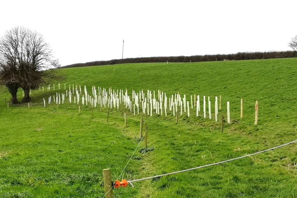
Cross-slope woodland planting, Acland NFM Project. Image credit: North Devon Biosphere.
Cross-slope woodland is the placement of smaller areas or typically belts of woodland across hill slopes.
It can include all woodland types and species, and can be managed as either productive or unproductive woodland.
2.1 What we know
We have low confidence in the effect that cross-slope woodland has on flood risk because of the lack of recently observed data.
It is thought that cross-slope woodland:
- has localised effects; however, this is based on limited research and may be due to difficulties of measuring impact at large catchment scales
- moderately reduces flood peaks, according to some studies, but this is mainly in lower magnitude events or intense summer storms
- storage capacity could be easily overwhelmed, especially in the wettest conditions, reducing the impact on flood peak reduction, according to one study
- can have soil infiltration rates up to 67 times higher within woodland plots and shelterbelts planted on improved grassland compared with grazed pasture, which reduced measured run-off volumes by an average of 78% compared with the control; this study was from Pont Bren and the findings may not be transferable
- has higher soil hydraulic conductivity values beneath the woodland at Pont Bren due to a greater proportion of larger soil pores and flow pathways provided by the tree roots; one other study showed that conductivity was higher under the woodland, although soil moisture dynamics returned to those similar to grassland 15 m downslope of the woodland
- can have impacts even in larger events, a modelling study drawing on the process measurements at Pont Bren predicted that planting tree strips across 7% of a 12 km2 headwater catchment could reduce a severe flood event (0.5% AEP) by an average of 5%
- increases hydraulic roughness, helping to slow run-off, but this depends on the structural characteristics of the individual woodland
- can be influenced by alignment, width and placement; interaction with surface run-off pathways has a big influence on its effectiveness at reducing flood run-off; generally the narrower the woodland, the larger the upslope area contributing run-off, and the shallower the soil, the smaller the expected effect
2.2 Examples
Observations of a 27-year old, mixed species cross-slope woodland (14 m wide,~9° slope) in the Eddleston Water catchment (67 km2), Scottish Borders found that the impact of this woodland is localised, and may be more effective in lower magnitude events or intense summer storms than in wetter winter periods (Peskett and others, 2020).
A modelling study in the Asker catchment, Dorset showed that cross-slope woodland planting on areas of existing grassland with underlying soils that were either free draining or slowly permeable, and with slopes between 10 and 30% gradient, reduced flood peak between ~43% for a 10-year return period event and 15% for a 100-year event (Ferguson and Fenner, 2020a).
Hillslope woodland was planted over 3.7 km2 in the upper catchment (15% coverage), 1.9 km2 in the middle catchment (8% coverage), and 1.6 km2 in the lower catchment (9% coverage). The modelling study showed an average peak flow reduction (across all event scenarios) of 9.3% (upper catchment), 7.9% (middle catchment), and 7.9% (lower catchment) (Mason-McLean, 2020).
2.3 Multiple benefits
Cross-slope woodland may result in benefits to water quality by trapping sediments and biodiversity by improving the connectivity of existing woodland patches.
No new literature was found in the update of the evidence directory.

2.4 What we need to learn more about
We need to better understand:
- the impact of differing slope angle and slope length on the efficacy of cross-slope woodland for natural flood management
- what the optimal soil/geological conditions, extents, and locations of forest cover are to have a larger catchment-scale influence
- how woodland design/management alters the effectiveness of cross-slope woodland, for example, what size, width, type, density and age of woodland is needed for the greatest benefit
- performance in large catchments
- the effect of tree stocking density on soil permeability and surface roughness
- the relative benefits of semi-natural woodland versus wood pasture, in upland pasture in particular
- the ability of hydrology models to upscale process understanding from the plot/site level to the catchment scale to better predict the effects of cross-slope woodland on flood risk
- the impact of cross-slope planting on water retention during a sequence of storm events
2.5 References
FERGUSON & FENNER, 2020a. Evaluating the effectiveness of catchment-scale approaches in mitigating urban surface water flooding. 378 (2168). Phil. Trans. R. Soc. A. 20190203
MASON-MCLEAN, 2020. (2020). Riparian buffer strips and their effectiveness as a natural flood management measure.
PESKETT, 2020. Catchment subsurface water storage, mixing and flowpaths: implications for land cover change as a natural flood management strategy. University of Edinburgh
3. Floodplain woodland
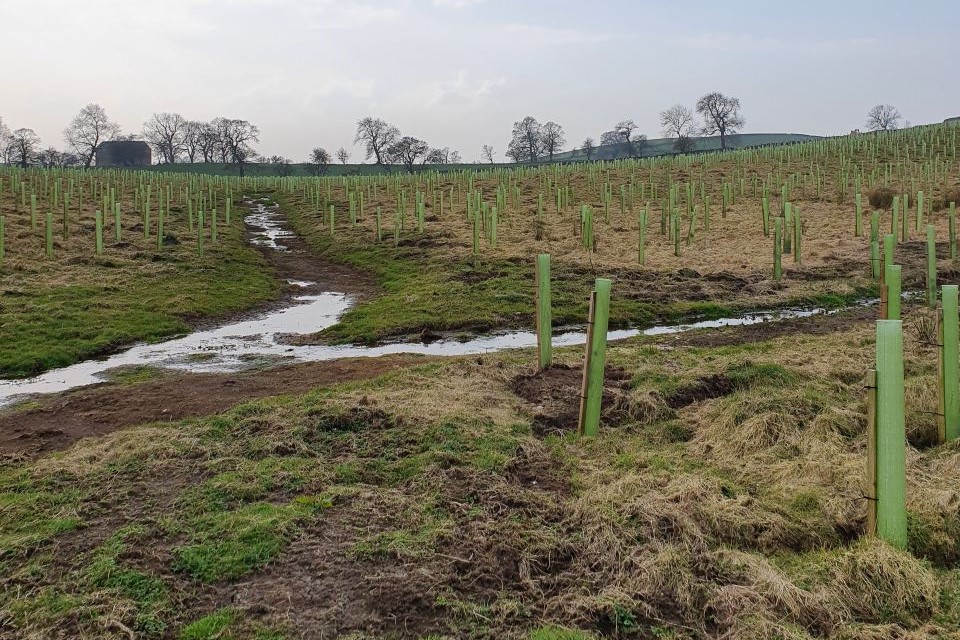
Floodplain woodland planting at Broughton Hall Estate. Image credit: Jenny Broomby, JBA Consulting
Floodplain woodland is all woodland lying within the fluvial floodplain that is subject to an intermittent, regular, planned or natural flooding regime.
It typically includes broadleaved woodland and can range from productive woodland on drier, intermittently flooded, areas to unmanaged, native wet woodland in wetter areas. Floodplain woodland usually covers a larger area than riparian woodland, often extending >5 m on either side of watercourses.
The main role of floodplain woodland is to slow down and hold back flood flows within the floodplain, and enhance sediment deposition to reduce downstream siltation. This is because of the higher hydraulic roughness presented by floodplain woodland in the form of trees, shrubs and deadwood, as well as the potential additional floodwater storage provided by associated multiple water channels and backwater pools.
3.1 What we know
We have low to medium confidence in the effect floodplain woodland has on flood risk due to the lack of research at the catchment scale.
It is thought that floodplain woodland:
- influences flood flows in a similar way to riparian woodland but with a larger footprint
- may be more effective in smaller events
- usually provides the greatest flood risk reduction in middle and lower river reaches in medium to large catchments
- affects both floodplain and channel hydraulic roughness by the physical presence of the trees, undergrowth and deadwood, slowing flood flows, as well as by the influence of these on diverting floodplain flows and driving the formation of multiple channels and backwater pools, storing water on the floodplain
- can reduce water velocity and raise local water levels on the floodplain, based on laboratory flume and process modelling studies demonstrating how its size/placement/orientation affects energy loss by resistance and turbulence
- has the greatest hydraulic roughness of all vegetation types, with a Manning’s ‘n’ value 5 times greater than grassland
- can significantly reduce water velocities and increase water levels on the floodplain, but with a relatively small reduction in flood peak, and with a significant delay to flood peak timing, providing significant scope to desynchronise sub-catchment flood waves and further reduce peak height
There is a risk that woodland planting could increase flood risk (via peak synchronisation/backwater effect); this impact can be reduced through careful design/placement.
3.2 Examples
Dixon and others (2016) predicted that the restoration of floodplain woodland within 10 to 15% of sub-catchments of the Lymington River would reduce the 3% annual exceedance probability (AEP) flood by 6% 25 years following planting.
In the Rogerscale floodplain restoration scheme in Cumbria, short rotation willow coppice planted perpendicular to the flow on the floodplain slowed the flow and captured debris. Comparing pre-NFM scenario modelled data for a 1 in 2-year return period event to the (qualitative) observed results in a similar magnitude event, the intervention led to a reduction in the depth and velocity of water movement across the floodplain (West Cumbria Rivers Trust, 2021b).
In a modelled study in Eddleston Water (67 km2), under a 1% AEP, riparian woodland gave a ~7% peak flow reduction. Results suggested that floodplain afforestation (29 ha) had a greater effect on peak flow reduction than upstream afforestation (5% and 1% AEP) (Dittrich and others, 2019).
3.3 Multiple benefits
Floodplain woodland may result in significant benefits to biodiversity. It can also have water quality, soil and climate regulation benefits. New literature suggests that wet woodland can break down and slow the transport of pollutants and provides specialised habitat. Floodplain woodland can provide thermal refugia and can also provide foraging habitat, improving habitat connectivity. Water resources benefits are relatively limited from floodplain woodland.

3.4 What we need to learn more about
We need to better understand:
- the effect of creating a large floodplain woodland across a range of catchment sizes on flood flows and standard of protection
- how important the effects of floodplain woodland are (for example, water use and evaporation, soil infiltration and storage, soil erosion and sediment delivery) for reducing flood risk, and how these vary between different types of woodland and types of catchment
- how to improve the way that models represent floodplain woodland in terms of woodland processes and appropriate parameter values, particularly floodplain roughness data
- how we can better capture the effects of floodplain woodland on local energy losses (for example, drag forces) and on floodplain geomorphology to incorporate into user-friendly models
- how terrestrial woodlands compare with wet woodlands from an FCRM perspective
- how best to use floodplain woodland combined with leaky barriers to avoid flood synchronisation effects
3.5 References
DITTRICH, BALL, WREFORD, MORAN, & SPRAY, 2019. A cost‐benefit analysis of afforestation as a climate change adaptation measure to reduce flood risk [Online]. 12 (4). J Flood Risk Management. Available from: https://onlinelibrary.wiley.com/doi/10.1111. [Accessed: 10 May 2023]
DIXON, SEAR, & NISLOW, 2019. A conceptual model of riparian forest restoration for natural flood management: Riparian Forest Restoration for NFM. 33 (3). Water and Environment Journal. 329–341
WEST CUMBRIA RIVERS TRUST, 2021b. Natural Flood Management Performance Monitoring - Rogerscale floodplain restoration. West Cumbria Rivers Trust
4. Riparian woodland
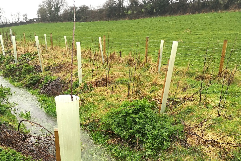
Riparian woodland planting, Woods4water project. Image credit: North Devon Biosphere
Riparian woodland is a woodland located in the land immediately adjoining a watercourse or standing water (known as the riparian zone). The zone is usually narrow, (5 to 10 m) on either side of watercourses. This allows for the natural addition of large woody debris into the watercourse.
It typically comprises native broadleaved woodland and is often unmanaged.
Riparian woodland slows down and holds back flood flows within the riparian zone, while reducing sediment delivery and bankside erosion. This is because of the high surface roughness associated with riparian woodland, in the form of trees, shrubs and deadwood, including associated large woody structures within water channels, which deflect and encourage out-of-bank flows.
4.1 What we know
We have medium confidence in the effect that riparian woodland has on flood risk; this has increased from the original evidence directory due to an increase in available literature.
It is thought that riparian woodlands:
- are well studied at reducing flood flows (at reach level)
- increase above-ground water storage because of the friction created by riparian trees; this slows flows and stores water
- work with leaky dams to reduce flood risk, with the latter potentially making a greater contribution to the reduction in flood risk
- have delayed benefits (one study suggested that there may be a lag time of up to 45 to 50 years before the benefits of the addition of large woody debris by riparian woodland is realised)
- maintain high evaporation losses and can create additional below-ground water storage
- impact on flood flows is much less researched at the catchment scale; as a result, modelled data provide the best source of evidence at the catchment level
- can moderately reduce flood peaks for smaller events, based on modelling studies
- placement in a catchment has a pronounced influence on flood risk; the largest reductions in peak flows resulted from planting arrangements which help desynchronise flood flows – typically in middle and upper catchments
- with younger trees may not delay lag time, with older/denser forests offering higher hydraulic resistance in one study
- with lower canopies may also exhibit higher resistance
- tree species and canopy should be considered, as canopy height and density may affect hydraulic resistance
- that modelling studies are thought to underestimate the impact of riparian woodland on flood flows by not fully incorporating the full range of woodland processes
It is important to note that washout of woody material from riparian woodland can potentially increase flood risk by downstream blockage. This risk can be managed by appropriate design and maintenance.
4.2 Examples
A modelled study in Calderdale showed that tree planting in gullies/cloughs resulted in a reduction of flood peaks ranging from 1 to 2% in 2 larger sub-catchments (19 km2 and 60 km2), to 2 to 3% in one small sub-catchment (5 km2) for all events (Willis and Klaar, 2021).
A monitoring study in the Eddleston catchment (69 km2), Scotland showed that 7.5 ha of riparian planting in a sub-catchment (6.89 km2) did not result in any delays in lag time under mean annual floods. As the trees were between 5 and 8 years of age, it was suggested that this may be due to the immaturity of the trees at the time of monitoring or other local factors (Black and others, 2021).
4.3 Multiple benefits
Riparian woodland may result in amenity benefits as well as benefits to water quality and biodiversity, with new literature suggesting that riparian woodland provides thermal refugia, creates marginal habitats and potentially reduces nitrate concentrations. It also provides climate regulation benefits.
Water resources, air quality and soil benefits are more limited from riparian woodland.

4.4 What we need to learn more about
We need to better understand:
- the effect of creating an extended network of riparian woodland across a range of catchment sizes on flood flows and standard of protection
- the effectiveness of riparian woodland in extreme events
- how important the various different effects of riparian woodland (for example, water use and evaporation; soil infiltration and storage; soil erosion and sediment delivery) are at reducing flood risk, and how do these vary between different types of woodland and different types of catchment (including interactions with leaky woody structures)
- the effect of different woodland designs, while considering existing land management practices (for example, drainage) and ecohydrology
- the difference of riparian woodland efficacy in different watercourse morphologies
- the impact of riparian woodland in rapid response catchments
- the effects of different tree species on riparian woodland efficacy
- the way that models represent riparian woodland processes, in terms of woodland processes and appropriate parameter values
- appropriate parameters and calibrated models to explore the effects of different woodland design and management on flood risk (including extent and placement within catchment)
4.5 References
BLACK, PESKETT, MACDONALD, YOUNG, SPRAY, BALL, THOMAS, & WERRITTY, 2021. Natural flood management, lag time and catchment scale: Results from an empirical nested catchment study [Online]. 14 (3). J Flood Risk Management. Available from: https://onlinelibrary.wiley.com/doi/10.1111. [Accessed: 28 April 2023]
WILLIS & KLAAR, 2021. NFM Calderdale: Summary Modelling Report 1.0. iCASP(NERC). 40